Railway Viaduct, St. Philips, Bristol: Difference between revisions
No edit summary |
No edit summary |
||
| Line 1: | Line 1: | ||
[[image:JD 2022 11 3.jpg|thumb|2022]] | [[image:JD 2022 11 3.jpg|thumb|2022]] | ||
[[image:JD 2022 11 4.jpg|thumb|Former loco shed on the right]] | [[image:JD 2022 11 4.jpg|thumb|Former Bristol Bath Road loco shed on the right]] | ||
[[image:JD 2022 11 5.jpg|thumb|]] | [[image:JD 2022 11 5.jpg|thumb|]] | ||
[[image:JD 2022 11 6.jpg|thumb|]] | [[image:JD 2022 11 6.jpg|thumb|]] | ||
| Line 9: | Line 9: | ||
Geograph entry [https://www.geograph.org.uk/photo/3224591 here]. | Geograph entry [https://www.geograph.org.uk/photo/3224591 here]. | ||
A short distance downstream is the new [[St. Philips Footbridge, Bristol|St. Philips Footbridge]]. | |||
Revision as of 10:02, 12 November 2022


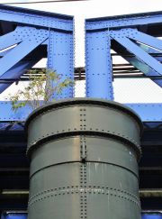
This is a bowstring and plate girder viaduct crossing the River Avon and Albert Road. The river span has a pedestrian footpath on the eastern side.
The line ran eastwards past Pylle Hill Goods Depot in the west, over St Philip's Marsh, across Marsh Junction, curving northwards and then westwards to connect with the GWR main line.
Geograph entry here.
A short distance downstream is the new St. Philips Footbridge.

